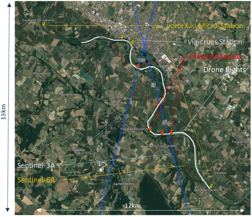
Title: Map of Garonne River cal/val super-site layout
Description: This satellite image shows the section of the Garonne River that makes for a cal/val super-site. Blue lines highlight the Copernicus Sentinel-3A tracks, and the red line shows a Sentinel-6A track. The Vigicrues station is highlighted in grey, vorteX.io micro-stations in yellow, pressure sensors in red, and the path of the drone flights over the river in white.
Copyright: vorteX.io
