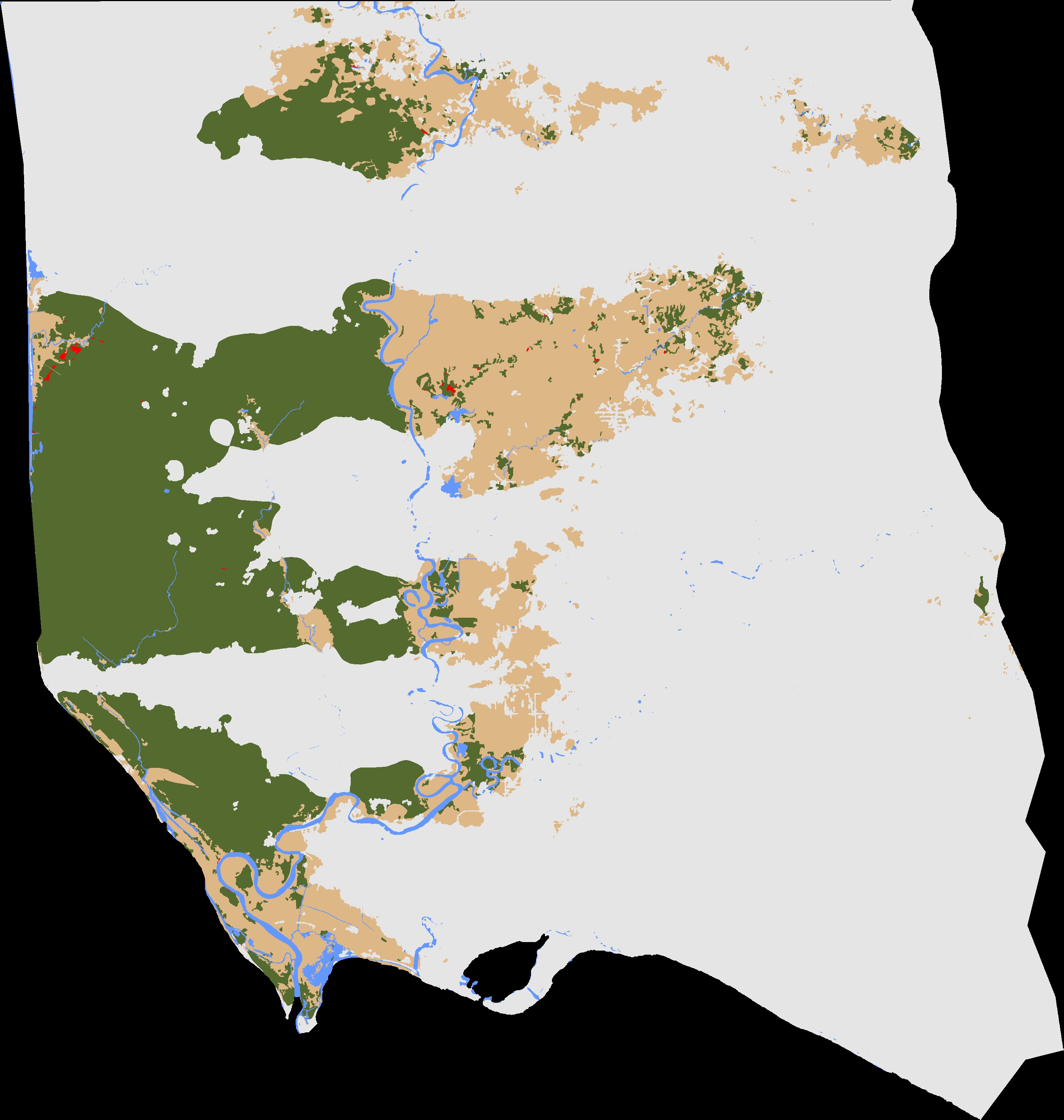
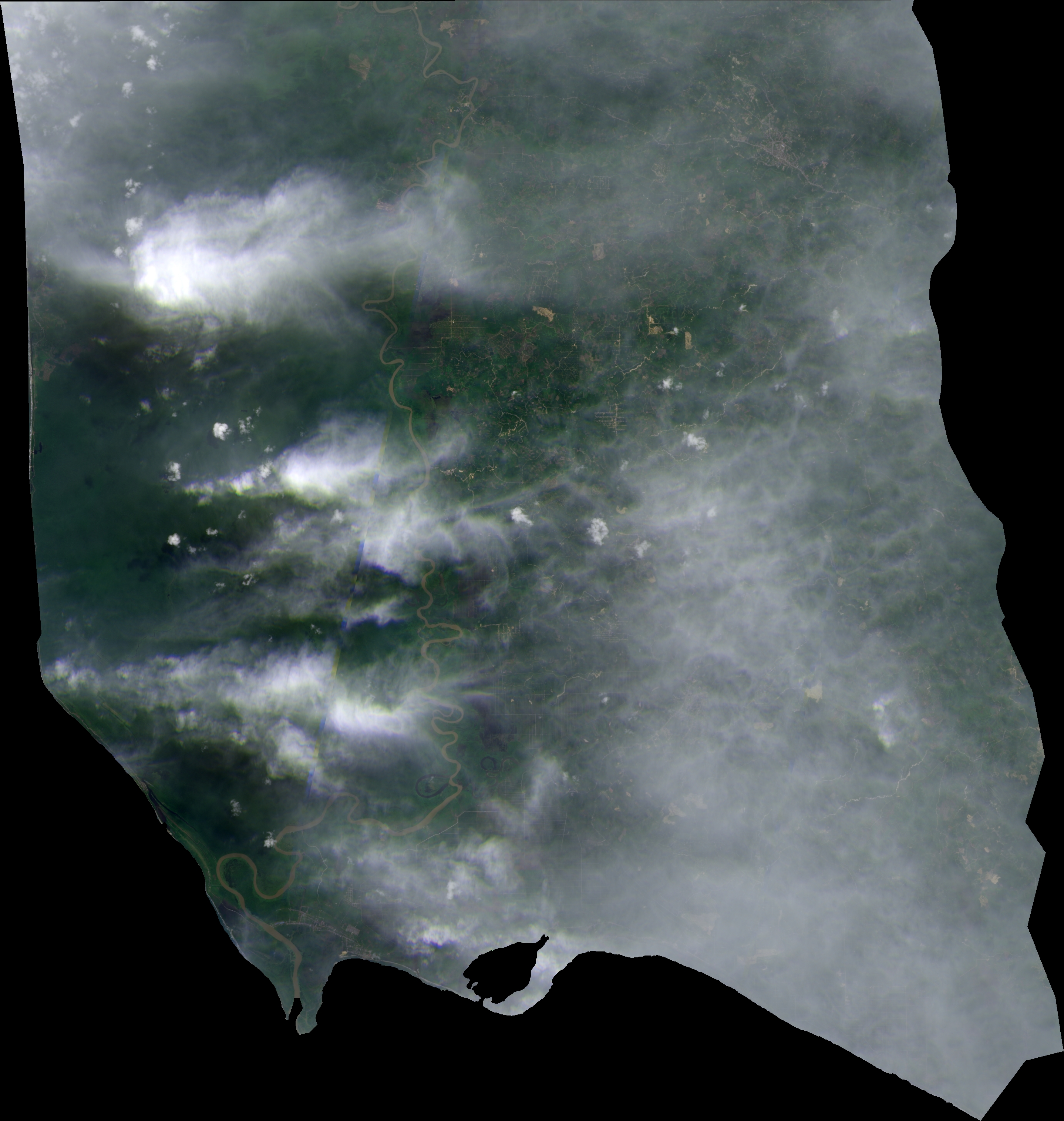
Title: Deforestation classification map
Description: Copernicus Sentinel-2 image (left, clipped on a Starling monitored site) and the classification map automatically produced by the Overland processor, showing new deforested areas (in red) and already-known forest in green. The objective is to best exploit Sentinel-2 images acquired every five days, even when atmospheric conditions are far from optimal.
Copyright: Contains modified Copernicus Sentinel data (2017)/processed by Starling