Title: Copernicus Sentinel-1 captures floods in the Laguna of Venice
Description:
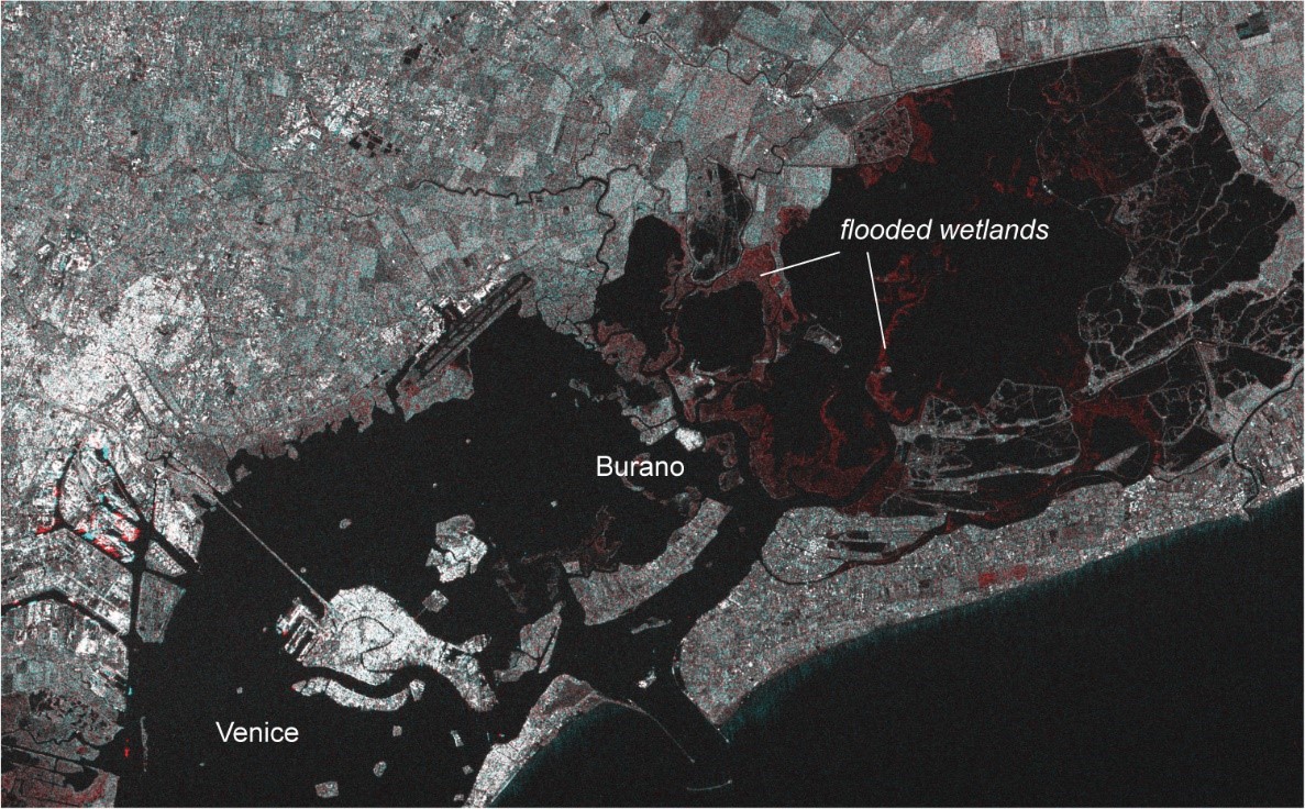
A combination of Copernicus Sentinel-1B radar images of 5 and 17 November 2019 clearly shows the flooded wetlands in red. As the Copernicus Sentinel-1 radar satellites sense Earth from an oblique angle, they cannot look into the narrow streets of Venice to detect the flooding there. But the wetland flooding is a direct indicator of the high water level in the laguna.
Copyright: Contains modified Copernicus Sentinel data (2019)/processed by the Department of Geosciences, University of Oslo