Observations by the Copernicus Sentinel satellites over Mount Agung in Bali, are helping scientists to monitor the ongoing eruption and identify any changes in magma pressure, possibly indicating whether a bigger eruption could occur.
In November 2017, Indonesian volcano Mount Agung began erupting once again, triggering the evacuation of more than a hundred thousand people and disrupting air travel. The previous 1963 eruption killed nearly 2000 people, making it one of the most catastrophic volcanic events in Indonesian history and among the deadliest volcanic eruptions of the 20th Century.
When the volcano started waking again last November, the Committee on Earth Observation Satellites (CEOS), asked to increase the frequency of Copernicus Sentinel-1 acquisitions over the area to six days, on both ascending and descending tracks.
The lead of the CEOS Volcano Disaster Risk Reduction Pilot, USGS Scientist Mike Poland, comments, "A major goal of our pilot was to see how useful satellites can be in responding to major volcanic events. With over 100,000 people evacuated, the eruption of Agung is already one of the most impactful in recent years".
However, the crisis may not be over. In 1963, the climactic eruption that claimed the most fatalities occurred many months after the first small eruptions. Lead scientist of the Bristol team, Juliet Biggs, says, "It remains imperative to monitor Agung, looking for any changes, which might indicate a transition to a more explosive type of activity. The Sentinel-1 data are important components in our monitoring toolkit, alongside the ground-based networks run by the Indonesian Centre for Volcanology and Geological Hazard Mitigation (CVGHM)."
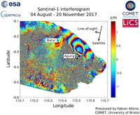
Fabien Albino, a postdoctoral researcher at the University of Bristol, and part of the UK's COMET network (Centre for Observation and Modelling of Earthquakes, Volcanoes and Tectonics), has been working on the Sentinel-1 data and explains, "So far, the Sentinel-1 data have shown slow uplift on the north flank of Agung, suggesting a deep, asymmetric build-up of magma pressure during the seismic crisis."
However, the tropical conditions at Agung mean that radar waves are slowed by water vapour in the atmosphere, causing false signals unless a correction is applied. Fabien adds, "Some data have misleadingly reported this atmospheric signal as deformation, and one of our biggest challenges has been ensuring that the decision-makers have access to the best possible information."
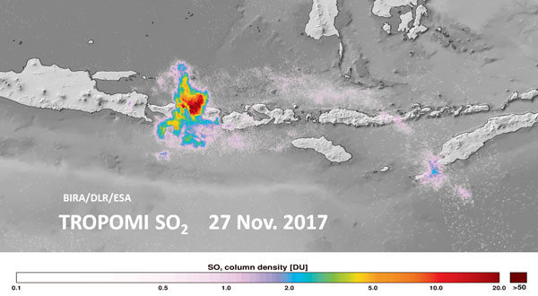
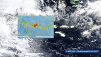
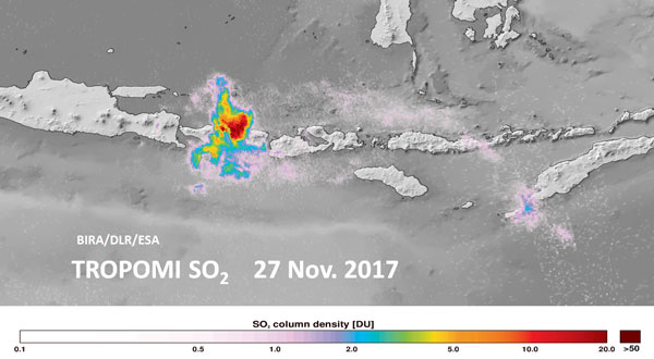
Furthermore, first light results from the recently launched Copernicus Sentinel-5P satellite highlight volcanic ash and sulphur dioxide emissions of Mount Agung, during 27 November 2017. Volcanic ash is especially hazardous for airplanes and must be avoided by them.
Such synergistic usage of Sentinel-1 and Sentinel-5P provide a good example of how the Sentinel satellites family can contribute to disaster monitoring, enabling faster assistance by relief workers.
About the Sentinels
The Sentinels are a fleet of dedicated EU-owned satellites, designed to deliver the wealth of data and imagery that are central to Europe's Copernicus environmental programme.
In partnership with EU Member States, the European Commission leads and coordinates this programme, to improve the management of the environment, safeguarding lives every day. ESA is in charge of the space component, responsible for developing the family of Copernicus Sentinel satellites and ensuring the flow of data for the Copernicus services, while the operations of the Sentinels have been entrusted to ESA and EUMETSAT.


