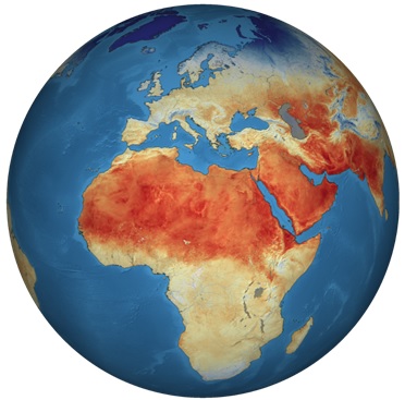
Global Land Surface Temperatures from Sentinel-3/SLSTR
data (2018). (Credit: ESA)
Heat emanating from the Earth's surface affects (and is affected by) the world's weather and climate patterns. A good indicator of this phenomenon is the land surface temperature. Scientists aim to study how rising land surface temperatures influence glaciers, ice sheets, permafrost and the vegetation in the Earth's ecosystems and how increasing atmospheric greenhouse gases affect land surface temperature.
Land surface temperature maps are also used for commercial agricultural purposes to evaluate water requirements during summer periods when crops may be exposed to heat stress or, in contrast, during winter periods, when crops and trees may be exposed to damaging frost.
For further information about land applications and services available, see: Copernicus website.