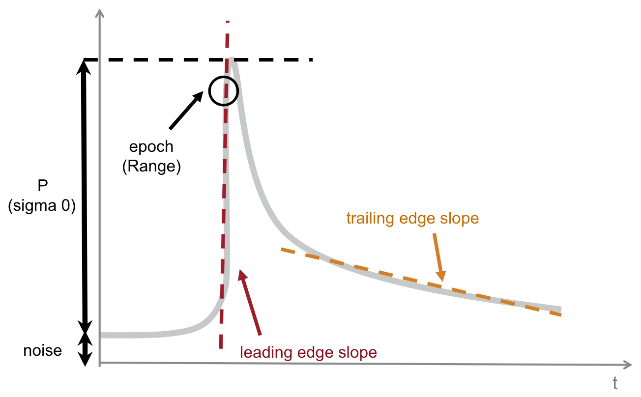
The main geophysical parameters to be measured by the Sentinel-3 topography mission are:
- Surface Height (SSH)
- Significant Wave Height (SWH)
- Wind speed over ocean surface.
These parameters are retrieved from the physical characteristics of the altimeter waveforms received by the SRAL instrument.

Figure 1: Physical Characteristics of the Altimetry Waveforms (Credit: isardSAT)
- Epoch: this is related to the range. SSH is computed from it.
- P: power of the useful signal. This power, with respect to the emitted power, gives the backscatter coefficient, sigma0. Sigma0 (together with the SWH) is used to estimate wind speed.
- Leading edge slope: this can be related to the Significant Wave Height (SWH).
- Trailing edge slope: this is linked to antenna mis-pointing and Significant Wave Height (SWH).
| Var/mode | NRT/STC/NTC | ||
| SARM | LRM | P-LRM | |
| Range | 1.25 cm | 1.67 cm | 2.53 cm |
| SWH | 9.7 cm | 11.4 cm | 16.2 cm |
| Wind Speed | 16 cm.s-1 | 21 cm.s-1 | 17 cm.s-1 |
| SSH | NRT | STC | NTC |
| NRT | 1.25 cm | 1.67 cm | 2.53 cm |