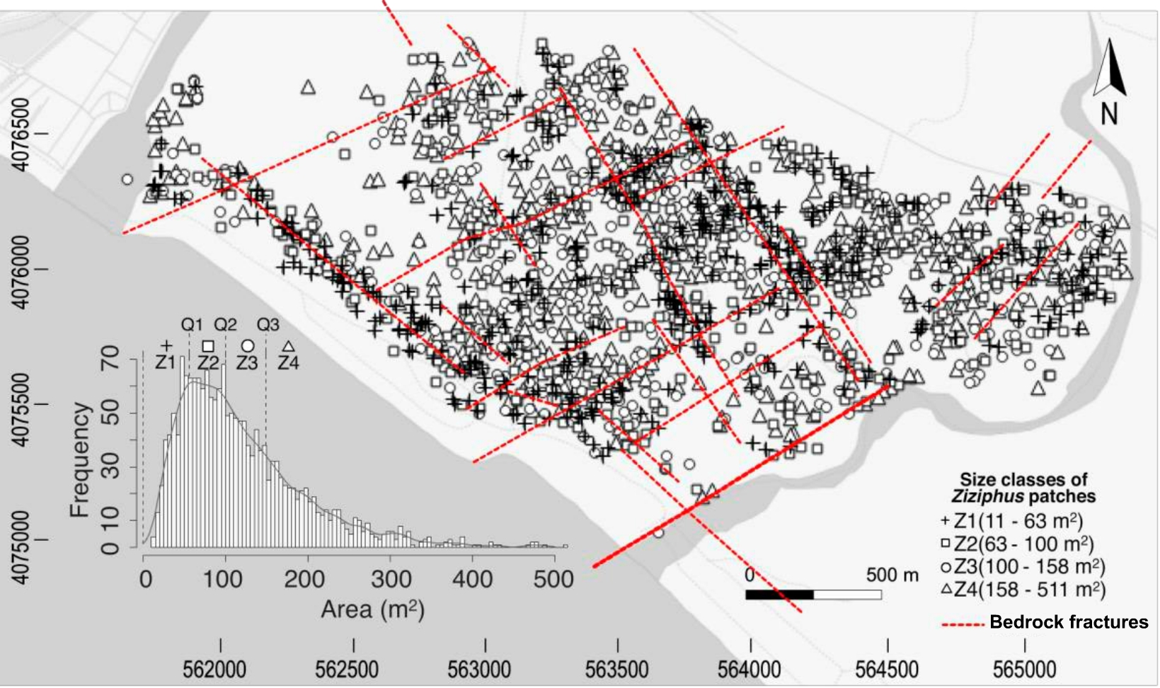
Title: Ziziphus patches and associated bedrock fractures
Description: This map features differentiated four size classes of shrubs (in black) and bedrock fractures (lines in red). The mapping was produced on object‐based image analysis of a 10 cm × 10 cm RGB orthoimage and a 1 m × 1 m lidar‐derived digital surface model, simultaneously acquired in August 2011.
The inset histogram shows the frequency distribution of the patch sizes and the quartiles used to separate them into four size classes. The lineaments of the Ziziphus patches can be visually discerned mainly along and perpendicular to the coast and to the east and west wadis (dry water channels, in grey) that limit the study area. The coordinate system is ETRS89 UTM 30N.
Copyright: Guirado et al., 2018. Wiley/Processed by Universities of Almería and Granada