Title: Surface deformation of Hualien area
Description:
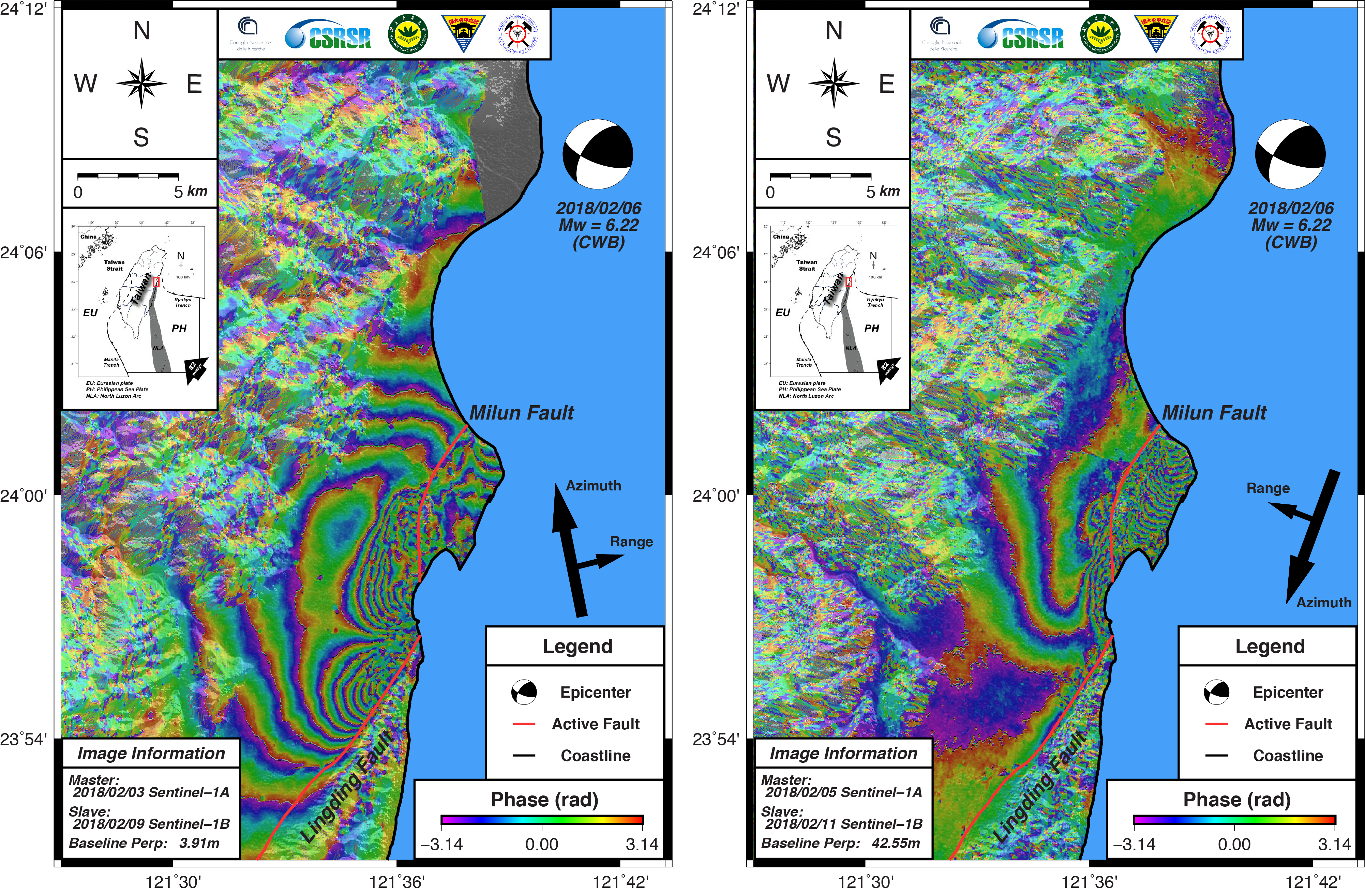
Scientists at the Eastern Taiwan Earthquake Center (ETEC) processed both Sentinel-1A and -B data just after the earthquake struck the Hualien area in Taiwan, producing these ground deformation maps. Thanks to the DInSAR information obtained by the Copernicus Sentinel-1 satellites, experts were able to quantify the extent of the damage.
Copyright: Contains modified Copernicus Sentinel data (2018)/processed by the Eastern Taiwan Earthquake Center (ETEC)