Title: Sentinel-1 interferogram of Kīlauea
Description:
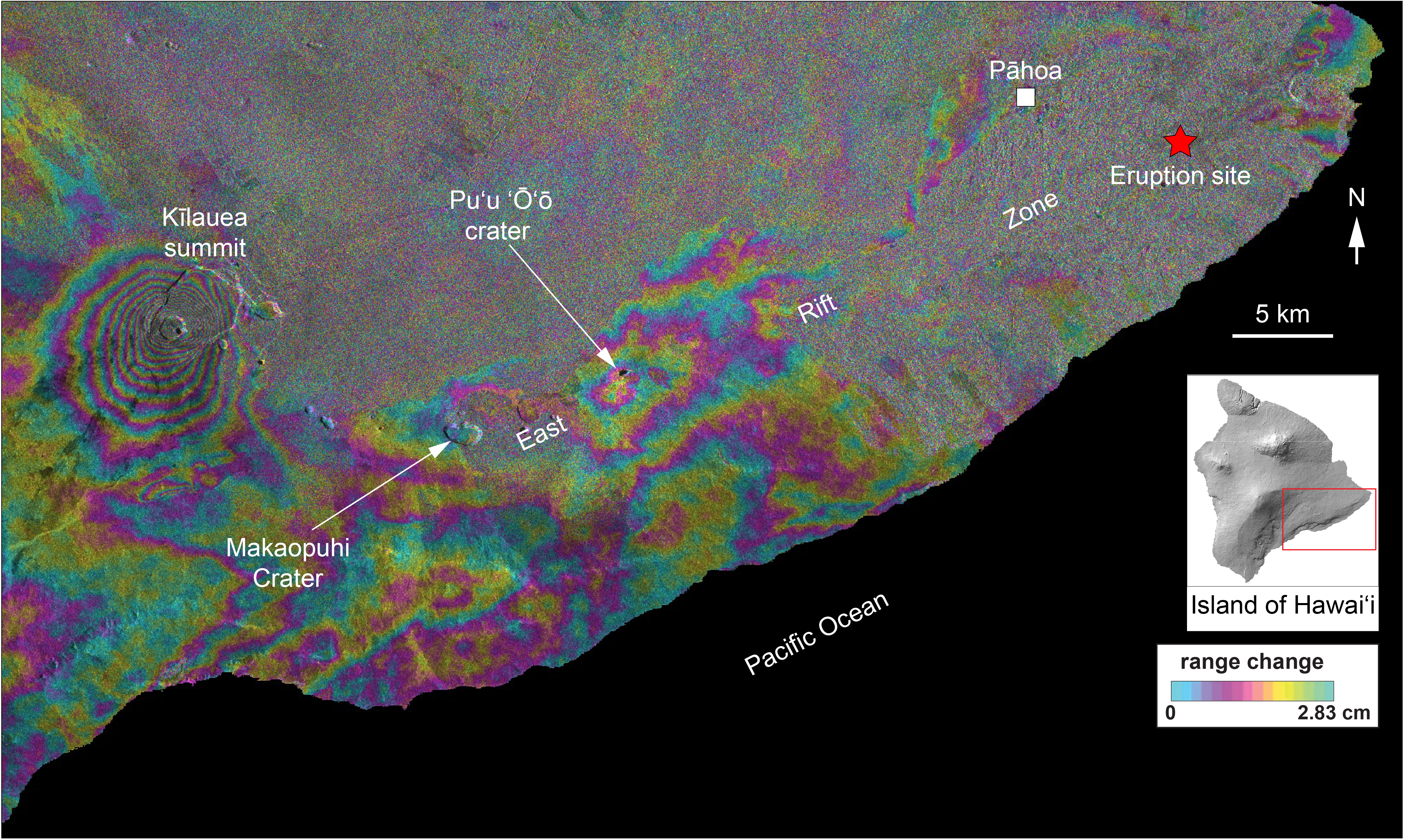
This interferogram is a map of surface deformation based on overpasses of the Copernicus Sentinel-1A satellite spanning 7 to 13 May local time. The coloured fringes indicate displacement of the ground surface. The pattern of fringes near Makaopuhi Crater and Puʻu ʻŌʻō indicate withdrawal of magma from the subsurface to feed the eruption, which is occurring about 40 km away along the volcano's lower East Rift Zone. Fringes in that part of the volcano are hard to discern owing to the heavy vegetation, but are apparent, indicating deformation due to rise of magma up to the surface in that area.
Copyright: Contains modified Copernicus Sentinel data (2018)/processed by USGS