Title: Ischia displacement maps
Description:
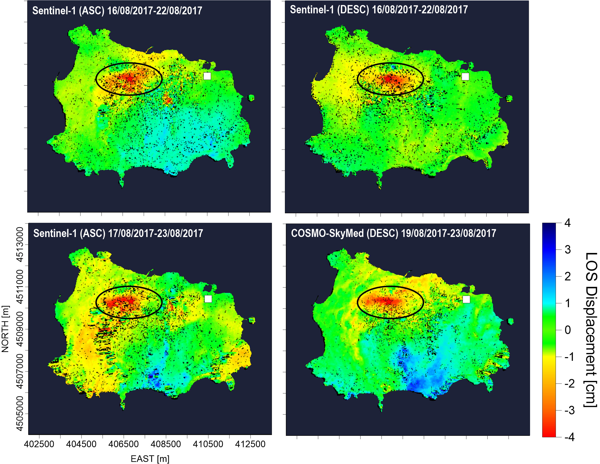
DInSAR (LOS) displacement maps computed by using Sentinel-1 images acquired from (anti-clockwise from upper right corner) descending orbits from 16 to 22 August 2017, ascending orbits from 16 to 22 August 2017 and from 17 to 23 August 2017, and COSMO-SkyMed images acquired from descending orbits from 19 to 23 August 2017.
The white square represents the DInSAR reference pixel, the red star is the mainshock of 21 August 2017 and the black ellipse indicates the area in which the maximum displacement was measured.
Copyright: Contains modified Copernicus Sentinel and COSMO-SkyMed data (2017)/processed by CNR-IREA