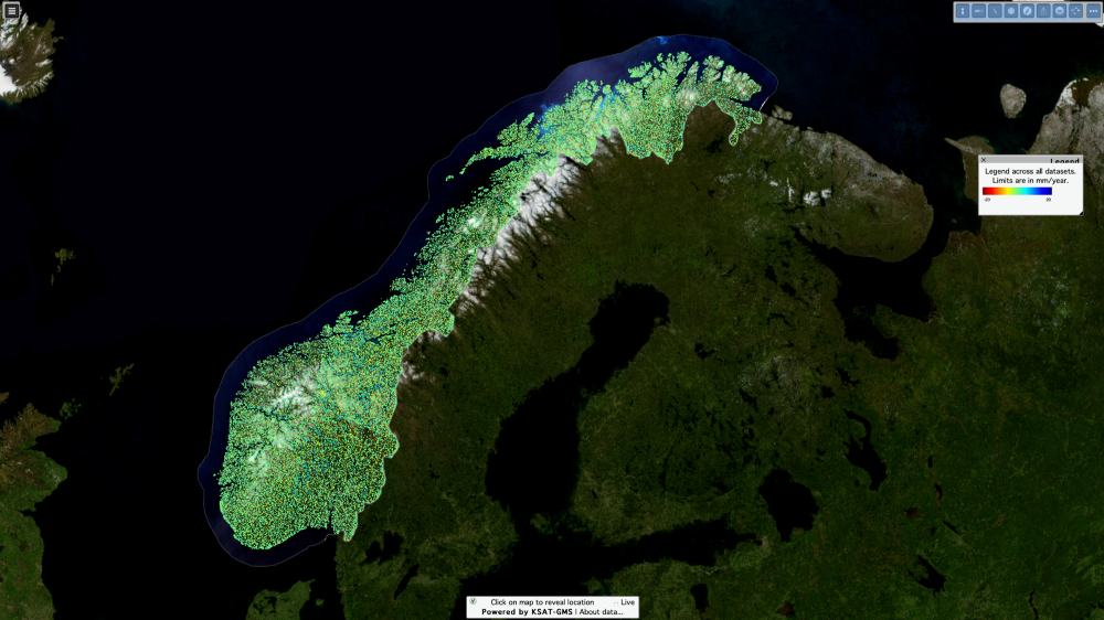
Title: InSAR Norway, a nation-wide ground motion monitoring service
Description: On 29 November 2018, the Geological Survey of Norway (NGU), the Norwegian Water Resources and Energy Directorate (NVE) and the Norwegian Space Centre launched the Norwegian Ground Motion Service, InSAR Norway, to help monitor and measure all of Norway's ground movements, using Copernicus Sentinel-1 data. InSAR data is given at full resolution, freely and openly available to everyone from the InSAR Norway portal.
The Norwegian research institute, Norut, and the Dutch company PPO.Labs, have been the research and development partners for InSAR Norway, through the KSAT-GMS partnership with the Norwegian Kongsberg Satellite Services (KSAT).
Copyright: Contains modified Copernicus Sentinel data (2018)/processed by InSAR Norway and powered by KSAT-GMS.
Satellite, terrain and map data courtesy of EC Copernicus, ESA, NGU, Norwegian Mapping Authority, Geovekst, Norwegian counties, NASA and USGS.