Title: Ground reflectance enables mapping the Anargyroi landslide
Description:
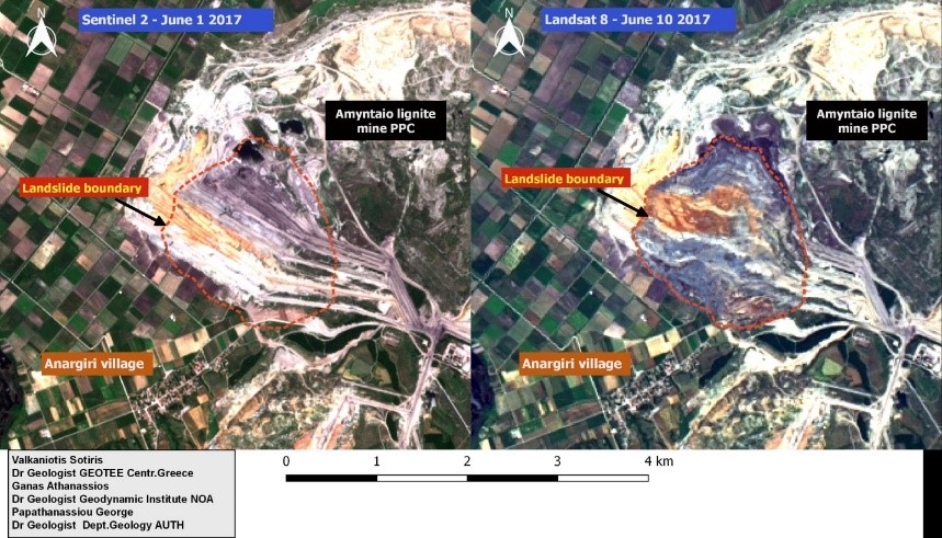
The Anargyroi landslide can also be mapped from changes in ground reflectance in optical images from the Sentinel-2 (1 June 2017 acquisition before the event) and the Landsat 8 (10 June 2017, shortly after) EO missions.
The images above show RGB true colour composites for both sensors. The bands were merged and pansharpened in a GIS environment, using the Semi-Automatic Classification tools (i.e. the SCP Plugin in Q-GIS) and the co-registration and change-detection was then performed using the Geomatica 2016 software. By using a high-resolution Digital Elevation Model (DEM) the direction of the landslide motion (towards the North) as well as the approximate volume of material, can be determined.
Copyright: Dr Sotirios Valkaniotis (GEOTEE), Dr Athanassios Ganas (NOA), Dr Georgios Papathanassiou (AUTH)