Title: Fractional vegetation cover from Sentinel-2
Description:
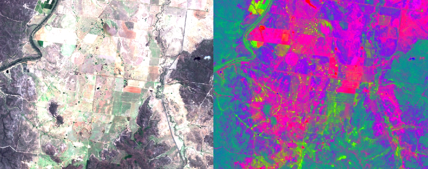
The Australian state governments of Queensland and New South Wales have adapted earlier Landsat-based methods to work with Sentinel-2 imagery. This example shows an area of mixed land use, including some pasture and cropped areas, with medium density woodlands.
The image on the left is a true-colour (red, green, blue) Sentinel-2 reflectance image. The darker areas are woodlands. The image on the right shows the same imagery, transformed using a model originally developed for Landsat which estimates fractional vegetation cover from the reflectance values. On each pixel, the proportions of red, green and blue represent the proportion of bare ground, live vegetation and dead vegetation respectively.
Copyright: Contains modified Copernicus Sentinel data [2016]/The State of Queensland (Department of Science, Information Technology and Innovation)