Title: Flooded areas over Houston, Texas
Description:
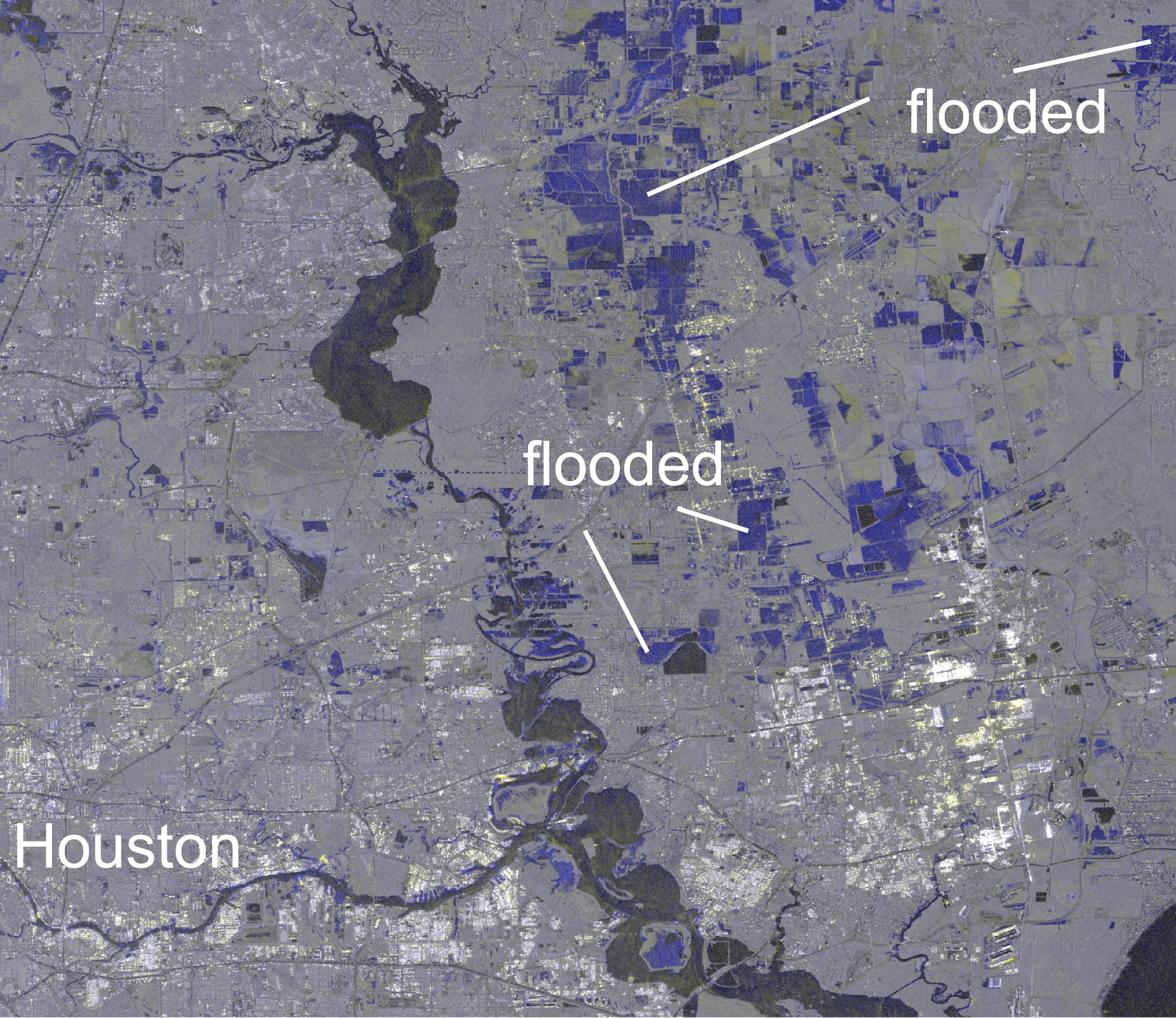
Images from the Copernicus Sentinel-1 radar satellite helped to map the floods after Hurricane Harvey struck Houston in August 2017. Particularly sensitive to water on Earth's surface, the composite radar images from before and during the flood show flooded areas in light blue.
Copyright: Contains modified Copernicus Sentinel data (2017), processed by A. Kääb at University of Oslo