The Copernicus Sentinel satellites have proven to be invaluable for various activations of the International Disasters Charter.
The Copernicus Sentinel satellites have proven to be invaluable for various activations of the International Disasters Charter.
Founded by ESA and the French and Canadian space agencies, the Charter is an international collaboration between 16 owners or operators of Earth observation missions. It provides rapid access to satellite data to help disaster management authorities in the event of disaster.
Since its founding in 2000, the 16 member agencies give rapid access to their satellite data, processing and data distribution assets. This enables decision makers, rescue teams and responders to reach victims quickly and organise rescue efforts.
The Charter has been used to respond to more than 520 disasters in over 120 countries.
Every six months, a different member takes the role of Primus Inter Pares – or Charter lead. In October, ESA took over this role for the sixth time, and is responsible for ensuring that the Charter's policies and rules are respected.
Some of the Charter's recent activations have involved the Copernicus Sentinel satellites.
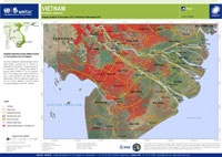
For example, on 04 November 2017, Typhoon Damrey hit Vietnam. Strong winds and heavy rainfall destroyed crops and trees and damaged property. Through the International Charter, data from the Copernicus Sentinel-1 mission were used to generate maps of flooded areas. Using these maps, it was estimated that about 700,000 hectares of land, mainly agricultural and paddy fields, were flooded.
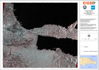
Last September, Hurricane Maria brought heavy rain and strong winds to the Dominican Republic as it continued its course through the Caribbean. The storm passed over the northeast coast of the island, causing floods and landslides.
At least two people were killed and it is estimated that 110 homes were destroyed and hundreds more suffered damage.
The RADARSAT-2 satellite and Sentinel-1 were used through the Charter to map ground saturation in Bajo Yuna, taking into consideration pre and post disaster images. The comparison of images taken before and after the hurricane struck made it easier to identify damaged areas.
In August 2017, floods in Bangladesh killed hundreds and affected more than 8 million people. It was estimated that 700,000 homes were damaged or destroyed.
The disaster occurred when monsoon rains struck the region, causing flooding further upstream in neighbouring countries such as Nepal. Flood waters flowed into overloaded rivers in Bangladesh, affecting almost a third of the nation.
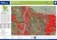
Through the Charter's activation, images from the Sentinel-1 satellite helped produce maps highlighting surface water extent and which areas were likely to have been affected.
In January 2017, devastating forest fires struck Chile. The fires began in the midst of a dry summer with record temperatures reaching 38°C. ONEMI - the Chilean National Office of Emergency of the Interior Ministry - reported 32 active fires, affecting the O'Higgins, Maule and Biobío regions to the south of Chile's capital, Santiago.
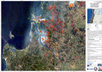
The International Charter Space and Major Disasters was activated, and data from the Copernicus Sentinel-2 mission produced disaster extent maps of the area around Concepcion in the Biobío region, helping to estimate that the fires destroyed more than 100,000 hectares of forest.
The EU-funded Copernicus Emergency Management Service – which provides maps free of charge to civil protection agents - cooperates with the Charter in order to avoid duplication, thus ensuring maximum assistance to victims. The maps produced by both services highlight the impact of international disasters and serve as a valuable resource for damage assessment efforts.
ESA's Maurice Borgeaud, current Chair of the Board of the Charter, says, "Together with data from the other Members of the Charter, those from the Sentinels of the Copernicus Programme make a great difference in Earth observation resources, allowing the Charter to coordinate the information received quickly and efficiently, to support the global community during emergencies".
At the recent Pecora conference in Sioux Falls, USA, the International Charter for Space and Major Disasters Team, now managed by ESA, received the prestigious award for its ‘outstanding support to the global community during times of crisis'.
About the Sentinels
The Sentinels are a fleet of dedicated EU-owned satellites, designed to deliver the wealth of data and imagery that are central to Europe's Copernicus environmental programme.
In partnership with EU Member States, the European Commission leads and coordinates this programme, to improve the management of the environment, safeguarding lives every day. ESA is in charge of the space component, responsible for developing the family of Copernicus Sentinel satellites and ensuring the flow of data for the Copernicus services, while the operations of the Sentinels have been entrusted to ESA and EUMETSAT.


