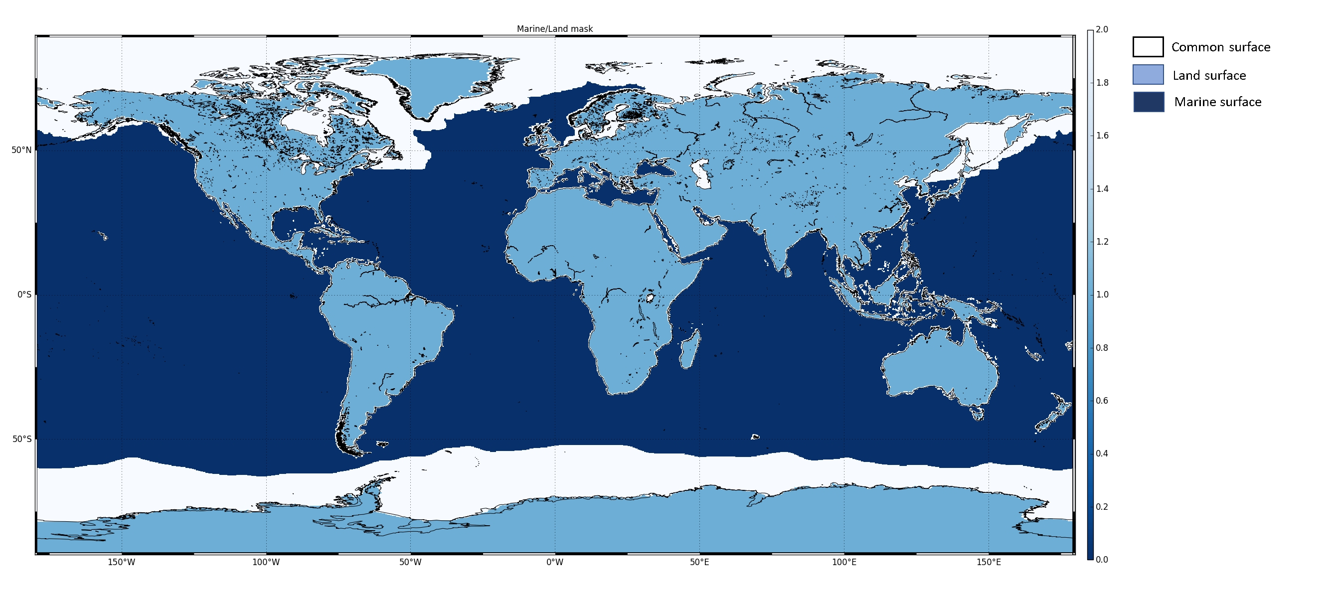
In agreement with the European Commission, a new definition of the geographical coverage of the Copernicus Sentinel-3 Altimetry Level-2 products has been recently defined.

The "NEW" Copernicus Sentinel-3 Altimetry Level 2 LAND products, generated by ESA, cover the continental surfaces as well as the sea ice surfaces, i.e. correspond to the "Land surface" and the "Common surface" as per the figure's legend.
The coastal overlap between the LAND products generated by ESA and the MARINE ones generated by EUMETSAT has been reduced to 50 km (25 km on each side of the coastline).
For any Inland Waters or Cryosphere applications, users are invited in using the ESA LAND Level-2 products; while for any Marine, Oceanic applications, the EUMETSAT MARINE Level-2 products are recommended.
This new geographical coverage of the Copernicus Sentinel-3 STM Level-2 products is effective since 9 July 2020, with the deployment of the new Copernicus Sentinel-3 STM Processing Baseline PB2.68 for Copernicus Sentinel-3A and PB1.42 for Copernicus Sentinel-3B.
For more detailed information on the LAND Level-2 products coverage please refer to the Land/Marine Mask definition page.
