The monitoring of land subsidence is of vital importance for low-lying countries, but also areas which are prone to peculiar ground instability.
The monitoring of land subsidence is of vital importance for low-lying countries, but also areas which are prone to peculiar ground instability.
Land subsidence is the lowering or sinking of the ground's surface, owing to changes that take place underground. Subsidence is usually due to a combination of ground water overexploitation, mining, natural consolidation of sediments and rapid urbanisation.
This is a major threat, in both urban and agricultural areas, where the continuous lowering over time can cause damage to buildings, sink houses, crack roads, and can cause severe impacts on the environment and economy. In order to support urban development projects and risk assessment efforts, subsidence monitoring is necessary.
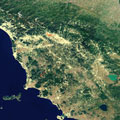
Along with the Veneto and Emilia Romagna regions in Italy, Tuscany is an interesting area to analyse, seeing as several cities such as Pistoia, are affected by land subsidence.
Conventional techniques to track and monitor this silent hazard, including repeat optical levelling and groundwater monitoring, can be difficult to manage in the long-term. By using radar data acquired by the Copernicus Sentinel-1 mission over time, ground deformation maps can be created in order to provide a regional monitoring system.
