Launched from Europe's Spaceport in French Guiana on 3 April 2014, the Copernicus Sentinel-1A satellite continues to gather radar imagery of Earth for a wide range of applications.
The first in the European Union's ambitious Copernicus programme, Sentinel-1A has been contributing valuable data to studies on land and at sea for nearly four years now, from its commissioning in September 2014.
A two-satellite constellation, Sentinel-1A was joined by its twin Sentinel-1B, on 25 April 2016.
Together, the two satellites have helped operational monitoring of sea-ice extent and drift, study changes to ice sheets – such as witnessing the dramatic break of Antarctica's Larsen C ice shelf in 2017 – and their data have provided innovative insights into ground deformation through the use of interferometry, being of particular use for earthquake characterisation, volcanoes, subsidence and landslide monitoring.
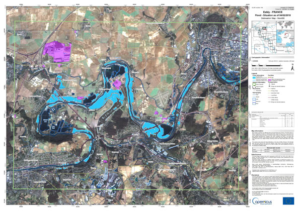
The synthetic aperture radar carried aboard both Copernicus satellites is able to acquire imagery without day, night or weather restrictions, which has enabled the mission to particularly help in disaster response activities following floods and storms.
Operational maritime surveillance (oil spill, illegal fisheries monitoring) and sea state (wind, and waves) are among other applications that benefit daily from Sentinel-1 data. Thanks to a high-coverage frequency, the use of Sentinel-1 data have also proved to be a key asset for land cover applications in general, including land classification, agriculture, forestry and hydrology.
This week, the 200th mission status report was published, detailing the latest activity of the mission. These weekly reports offer a look at the state of the satellites and provide information about activities the mission has supported.

Example of Copernicus Sentinel-1A/-1B contribution to the exceptional floods that occurred in Jan/Feb 2018 in Northern France - © Contains modified Copernicus Service information [2018], processed by the Copernicus Emegency Management Service.
