Nearly 100 young scientists from 30 countries recently gathered at the Szent István University in Hungary, to attend a training course on land applications using satellite data and tools.
Nearly 100 young scientists from 30 countries recently gathered at the Szent István University in Hungary, to attend a training course on land applications using satellite data and tools.
Sponsored by ESA and hosted by the Szent István University with support from the Hungarian Space Office, the 7th edition on Land Remote Sensing was part of ESA's series of advanced training courses on the use of Earth Observation data.
Taught by a team of 18 leading European professors and senior scientists, the course took place in Gödöllő, from 04–09 September 2017.
The majority of the attendees were postgraduate university students, while a number of participants represented the private or public sectors.
The objectives of the course were to train the young scientists to use state-of-the-art techniques in space-based land science and applications, providing a better understanding of the key concepts of current EO missions and data, in particular those of the European Union's Copernicus Sentinel missions.
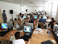
It also offered hands-on experience with software tools and methods used for data exploitation.
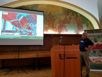
The course was formally opened on 04 September by the SZIU Rector, János Tőzsér, and Erika Michéli, Head of the SZIU Institute of Environmental Science. Presentations were made by ESA on the current status of EO missions and the data available to the science community.
Overviews of relevant EO-related activities in Hungary were given by representative Zoltán Zboray of the Hungarian Space Office (HSO) and by Dániel Kristóf, of the Department of Geodesy, Remote Sensing and Land Offices, of the Budapest Government office.
Participants were given an overview of the theoretical aspects of optical, thermal and microwave remote sensing, and the main tools available for processing and visualisation of ESA and non-ESA data, in particular those of the Sentinel-1, -2, and -3 missions of the European Union's Copernicus programme.
Experts provided examples and hands-on demonstrations of science and applications in land use monitoring, vegetation and forest mapping, urban mapping and heat islands, terrain motion, the monitoring of land-based processes of the water cycle, and new developments in cloud computing.
A dedicated poster session where the students presented their research was held during the week. The session was judged by a scientific committee and five posters were selected for the best poster awards.
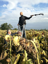
For the first time during an ESA training course, a field trip was organised and demonstrations were given on field spectroscopy and collection of data, using a drone. The field visit focused on examining the effects of seasonal standing water on agriculture—crop loss by ponding water being a major issue of the Great Hungarian Plain.
This was supported by time series analysis of Sentinel-2 imagery, during the last day of the course.
Vivien Pacskó, of the Eötvös Loránd University, Hungary, and winner of the best poster award in the Radar Remote Sensing category, says, "It was really motivating for me to meet such qualified lecturers and such open-minded participants. I had already used these toolboxes, SNAP and PolSARPro, but only for one specific task. I found it interesting to see that they could be used for many more things connected to remote sensing."
Laurent Ferro-Famil, Lecturer from the Université de Rennes 1, France, added, "The participants were fantastic, they came from very different backgrounds and sometimes did not really study engineering. We presented some quite complex physical processes and techniques to them and they really got involved all the time, trying to transfer our techniques to their problems. They are the future of what we are doing."
About the Sentinels
The Sentinels are a fleet of dedicated EU-owned satellites, designed to deliver the wealth of data and imagery that are central to Europe's Copernicus environmental programme.
In partnership with EU Member States, the European Commission leads and coordinates this programme, to improve the management of the environment, safeguarding lives every day. ESA is in charge of the space component, responsible for developing the family of Copernicus Sentinel satellites and ensuring the flow of data for the Copernicus services, while the operations of the Sentinels have been entrusted to ESA and EUMETSAT.


