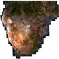
With the pair of Sentinel-2 satellites now in orbit, users are looking ahead to mapping global land cover at 10 m resolution.
With the pair of Sentinel-2 satellites now in orbit, users are looking ahead to mapping global land cover at 10 m resolution.
Land-cover mapping breaks down the different types of material on Earth's surface, such as water bodies, ice cover, different forms of agriculture or forests, grasslands and artificial surfaces.
This information is important for understanding changes in land use, modelling climate change extent and impacts, conserving biodiversity and managing natural resources.
ESA has been coordinating global land cover maps since 2002 through its GlobCover and Climate Change Initiative (CCI) Land Cover projects at a resolution of 300 m. But with the Copernicus Sentinel-2 pair now becoming operational, the possibility of a global map at 10 m is just on the horizon.
