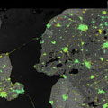
For a low-lying, densely populated country like the Netherlands, monitoring subsidence is critical. Until recently, tiny displacements in the ground beneath our feet couldn't be mapped nationally but, thanks to the Sentinel-1 mission, this is now possible.
For a low-lying, densely populated country like the Netherlands, monitoring subsidence is critical. Until recently, tiny displacements in the ground beneath our feet couldn't be mapped nationally but, thanks to the Sentinel-1 mission, this is now possible.
Focusing on the Netherlands and Denmark, scientists have been using radar images from the Sentinel-1A satellite to pinpoint where the ground is stable, where it is rising and where it is sinking - and, importantly, by exactly how much.
Images from November 2014 to April 2016 and 2.5 million measurement points were used to compile the map above, which shows subsidence and uplift in the northeast of the Netherlands. Most of these measurements were made around buildings and constructions such as dikes.
Remarkably, these measurements are accurate to a few millimetres. However, within a couple of years this accuracy will improve further, approaching 1 mm/year over the entire country.
