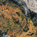
The unprecedented frequency of Sentinel observations capture rapid changes in agricultural production from national to field scale, serving as a major support for environmental monitoring and agricultural subsidy control.
The unprecedented frequency of Sentinel observations capture rapid changes in agricultural production from national to field scale, serving as a major support for environmental monitoring and agricultural subsidy control.
The Sentinel satellites of Europe's environmental Copernicus programme are used, among other things, to study changes in farming on a weekly basis, with a 10 m resolution, and with a free and open data policy.
Europe's Sentinel-1 and Sentinel-2 satellites allow us to observe subtle changes in land use. For instance, which crops are being grown and how fast or well they are developing, as well as spotting differences within single, larger fields.
This information can be used for different purposes - from predicting seasonal yields to preventing hunger in some parts of the world. Planning can help to mitigate an expected bad harvest, for example.
