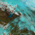
Wildfires have been raging in Canada's Alberta province for nearly three weeks, causing widespread destruction and forcing thousands of people from their homes. As the blaze grows and shifts, satellites are tracking its movement.
The exact cause of the wildfires has not been determined, but unseasonably hot and dry weather has contributed to their rapid growth.
Satellites from numerous space agencies across the globe have imaged the fires, including the recently launched Sentinel-3A for Europe's Copernicus programme.
Launched in February, Sentinel-3A is still being commissioned - engineers are checking to make sure the satellite and its instruments are working properly before the data can be distributed for operational use.
