With the new Earth observation satellites carrying a range of technologies such as radar and multispectral imaging instruments for land, ocean and atmospheric monitoring, data are available for the next 20-30 years. However, this means little unless there are capable people handling them.
With the new Earth observation satellites carrying a range of technologies such as radar and multispectral imaging instruments for land, ocean and atmospheric monitoring, data are available for the next 20-30 years. However, this means little unless there are capable people handling them.
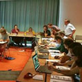
ESA's Ocean, Land and Atmosphere Training Courses ensure this. Held in various European universities and research organisations, they involve leading European scientists and key remote-sensing experts, focused on training the participants on how to use open-source tools developed by ESA to exploit new data streams.
As Prof. Johannessen, Vice Director of Nansen Environmental and Remote Sensing Center in Norway, states: "The ocean training courses that ESA arranges offer a comprehensive overview of satellite remote sensing. Attendants get a good understanding on the key steps in the processing, development and use of retrieval algorithms.
"Moreover, the amount of satellite data are growing very fast and demand highly skilled capacities at all levels, to ensure full use of these very important data."
