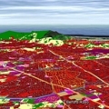
The risk of natural disasters can be reduced by understanding our environment and the fundamental forces that shape it. Earth-observing satellites can provide vital information to mitigate and prepare for disasters.
The risk of natural disasters can be reduced by understanding our environment and the fundamental forces that shape it. Earth-observing satellites can provide vital information to mitigate and prepare for disasters.
Every year, the wet plains of southeastern Cambodia are subject to flooding from the Mekong River during South Asia's monsoon season. The waters threaten infrastructure and crops, putting lives and livelihoods at risk.
But satellites provide data that can be used not only in Cambodia but also in many other high-risk areas around the world. These data can support risk assessment for a range of hazards, from hydrometeorological risks to geo-hazards such as landslides and terrain subsidence.
